Reading terrain shape when the light goes flat
Flat light erases contrast before it erases the terrain. Ridges, gullies, and rolls are still there — you just can't see them the way you normally would.
The problem
In flat light or a whiteout, your eyes lose the shape of the terrain long before visibility technically drops to zero. A gully or a roll that would be obvious on a sunny day can disappear into a uniform gray.
Why it happens
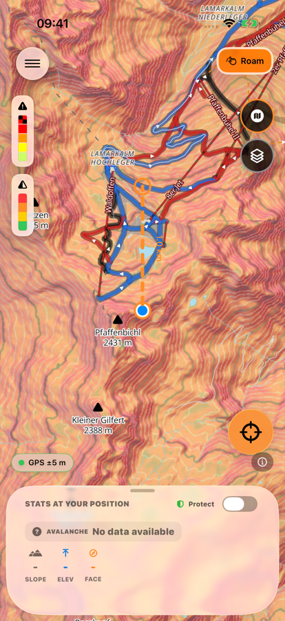
Hillshade simulates sunlight striking the elevation model from a fixed angle, giving the map a 3D sense of ridges and gullies even when the real light outside is flat. Contours connect points of equal altitude, so tightly spaced lines mark steep terrain and gullies directly.
How to check it in First Chair
-
Turn on Hillshade
It brings back a sense of relief and shape even when the real light is flat.
-
Layer Contours on top
Tightly spaced lines mark steep terrain and gullies; evenly spaced lines mark rolling or flat ground.
-
Point the lens ahead before moving in
In Shoot/Compass mode, check terrain shape before committing to ground you can't read by eye.
-
Plan the line before you go
Reading the map is not the same as being able to see what's actually in front of you — use it to decide, then move deliberately.
Free to download · iPhone & Apple Watch
Download on the App Store