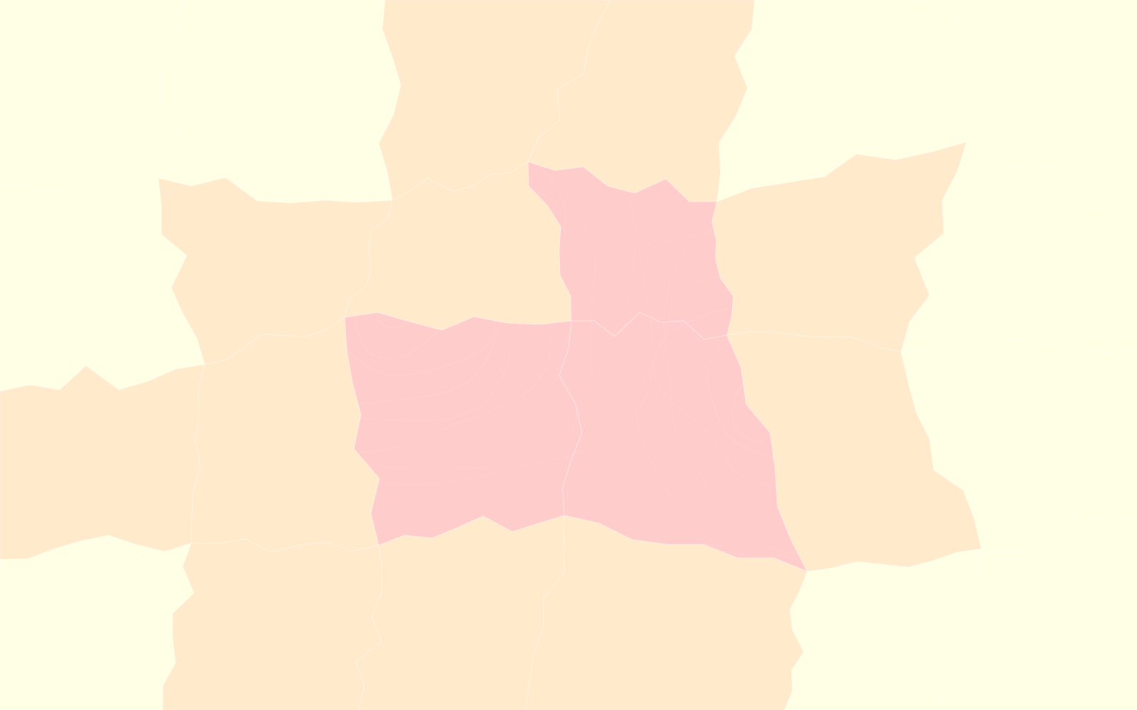


Steepness
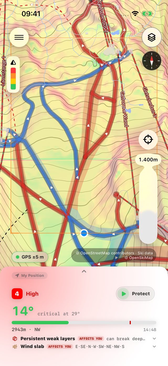
How steep is it?
Slope colours from flat to 45° and beyond.
Avalanche risk live on your Lock Screen, any slope in 3D, and every resort you love, hour by hour.
Free · iPhone & Apple Watch · Android coming soon →
Avalanche danger scale
Level 3 · Considerable · looks harmless
Do you know the level
where you're standing?
Protect Mode · scroll to climb
Start Protect and First Chair follows your GPS: your height and the way your slope faces. Here: level 3 below 2,400 m, so slopes are critical from 34°.
40° on this east-facing leg.
Steeper than today's 34°.
Your Lock Screen turns red the moment you're on it, measured against the critical angle for today's danger level. Wind slab sits on east-facing slopes above 1,600 m: that's you. Persistent weak layers only start at 2,000 m.
Your call.
Back 200 m, then the line to the left.
First Chair doesn't choose your line. It tells you what you're standing on. Turn around, drop 30 m, and the line to the left stays under 34° all the way to Sommerbergalm. The direct line, dashed, stays red.
Above 2,400 m it's level 4.
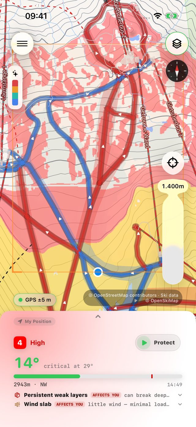
Now critical from 29°.
Same mountain, new limit. The 31° on this north-west leg would only be amber below the line. Up here it's red.
Four problems in the report.
One at a time, on the mountain.
Each one sits on certain aspects and heights, hatched on the mountain one by one. Wind slab is on east-facing slopes; you're on a west face. Wet snow counts from 12:00, as the sun warms the west faces. All of it on your Lock Screen, without opening the app.
Your day, slope by slope.
Valley to summit, six hours.
Green where you were fine, amber where it got close, red where it was steeper than the day allowed. Your whole tour, looked back on, slope by slope.
What about the slope ahead? Aim at itOn your Lock Screen, live
Persistent weak layers · New snow · Wind slab · Wet snow
Zillertal Alps Northeast
Real terrain at the Hintertux Glacier, from the Gletscherbus valley station to the Gefrorene-Wand-Spitzen, with a sample avalanche report. In the app, every value comes from today's official report.
Protect Mode · before you go up
Up there, coverage comes and goes. So Protect Mode doesn't start until everything it needs is already on your phone: the terrain, today's avalanche report, the forecast. If a check fails, it tells you why and doesn't start.
Once it's on, slope, aspect and altitude come from the downloaded terrain and your GPS. Neither needs a signal.

3D terrain · from where you stand
In Compass mode the map follows the way your phone points. Turn toward the slope you want to know about, put it in the aiming box and shoot. First Chair measures it from your position.
3D terrain · anywhere on the map
Across the valley, the next couloir, tomorrow's tour: drag the map, put the slope in the aiming box and shoot. First Chair builds the terrain in 3D and reads it for you.


Swipe the lens. The same mountain answers a different question each time.
How steep is it?
Slope colours from flat to 45° and beyond.
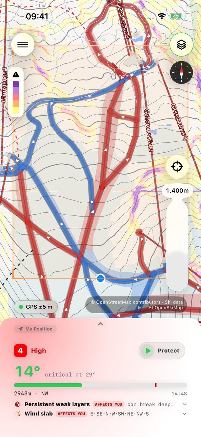
Is it avalanche terrain?
30° and steeper, weighted by today's bulletin.
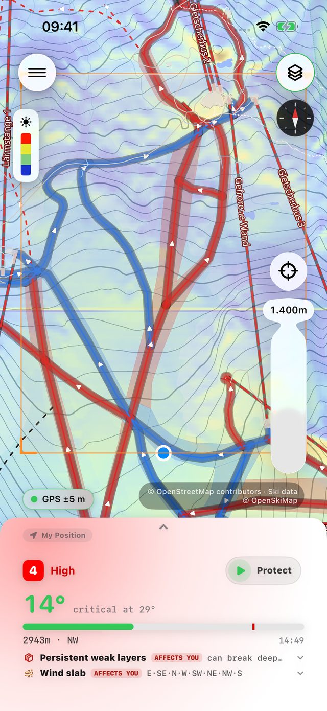
When does the sun hit it?
Day average or hour by hour, for corn and slush timing.
Where is the good snow?
A score from new snow, wind, sun and the bulletin.
Plus cliffs, wind drift,
snowfall and live radar.
Resort pages
Every resort you love on one page: mountain weather from valley to peak, live webcams, the avalanche bulletin and a snow score, with an alert when new snow lands.
Open a live example: Hintertuxer Gletscher → Already have the app? Open it there →


Download your resort before you go. Elevation, satellite, basemap, runs, lifts and terrain layers stay on your iPhone, so the map, shots and slope angles work on the ridge without a bar of signal.
Available offline.
Favorites also show up in the Favorite Resorts widget. Download on Wi-Fi before the trip: a resort is tens to a few hundred MB.
How downloading works →Notifications
Every evening First Chair checks tomorrow's snowfall forecast for your favorite resorts. When one beats your threshold (10, 20 or 30 cm), you get one notification that lists them all.
The report for Tyrol, South Tyrol and Trentino comes out around 5 pm and is updated in the morning. First Chair tells you as soon as it's out, with the day's highest danger level, on the weekdays you pick.
Both are switched on in Settings and work without opening the app.
One more layer
Not a guarantee · not a replacement
Data from
Public, official and open data. The app lists every source with its license under Settings → Data & Licenses.
First Chair is iPhone-only today. Leave your email and we'll send exactly one message when the Android build is ready.
know more
before you ride.
Avalanche course · beacon · shovel · probe
Free · iPhone & Apple Watch · Android coming soon →
Merch
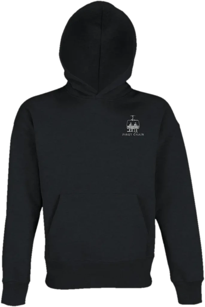
Designed by the First Chair team, sold through our Etsy shop.
Oversized HoodieBlack · recycled blend · unisex
Every order above €100 gets a First Chair Ambassador lifetime voucher.
Ambassador means lifetime First Chair Pro access and a spot in the beta program. The voucher comes with your order.